| Openings Amalgamations Closure | Tavannes - Tramelan (TT) | * 08-16-1884 |
| Saignelégier - La-Chaux-de-Fonds Est (SC) | * 12-07-1892 | |
| La-Chaux-de-Fonds Est - Gare (SC) | * 11-28-1893 | |
| Saignelégier - Glovelier (RSG) | * 05-21-1904 | |
| Tramelan - Le Noirmont (TBN) | * 12-16-1913 | |
| Amalgamation TT-TBN zu CTN | 01-01-1927 | |
| Amalgamation SC-CTN-RSG-RPB zu CJ | 01-01-1944 | |
| Saignelégier - Glovelier (narrow gauge) | * 10-04-1953 | |
| Electification | from the beginning | |
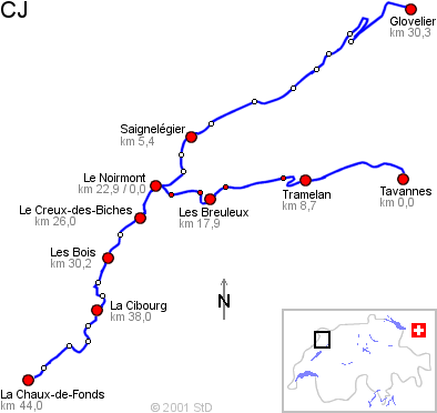
| Technical facts | Gauge | 1000 mm |
| Length | 73727 m | |
| Maximum gradient | 2,6 % | |
| Minimal radius | 70 m | |
| Power supply | DC 1500 V | |
| Bridges | 25 | |
| Tunnel | 8 | |